- UPSC Exam
- State PCS
- One Day Exam
- Current Affairs
- PT Quiz
- Downlaods
- About Coaching
- Blog
- Videos
| Prelims: (Polity & Governance + CA) Mains: (GS-3 – Environment Conservation, Infrastructure Development, Science & Technology) |
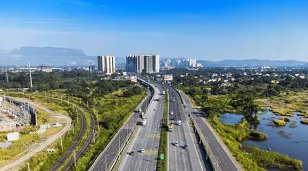
The National Highways Authority of India has released the first National Highways Green Cover Index (NH-GCI), a technology-driven tool designed to assess the extent of vegetation and green cover along India’s national highways network.
The index has been developed in collaboration with the National Remote Sensing Centre under the Indian Space Research Organisation, using satellite-based remote sensing technologies to provide a scientific measurement of green cover along highway corridors.
The initiative marks an important step toward sustainable infrastructure development and environmental monitoring in India.
India has rapidly expanded its road infrastructure in recent years to support economic growth, connectivity, and logistics efficiency.
The National Highways Authority of India manages a vast network of highways that form the backbone of the country’s transportation system.
However, large-scale highway construction can lead to:
To address these concerns, the government has emphasised green highways and large-scale roadside plantation programmes.
Monitoring the effectiveness of such plantation initiatives requires scientific and objective tools, which led to the development of the NH Green Cover Index.
The National Highways Green Cover Index is a satellite-based index that quantitatively measures vegetation cover along national highway corridors.
It provides a scientific assessment of green cover within the Right of Way (RoW) of highways.
The index measures the percentage of land covered with vegetation along highways, including plantations along the left and right sides of roads and the central median wherever feasible.
By providing measurable data, the index allows policymakers to monitor environmental sustainability in highway development.
The index has been developed with technical support from the National Remote Sensing Centre, a key research centre under the Indian Space Research Organisation.
Using high-resolution satellite sensors, scientists are able to detect vegetation through chlorophyll content present in plant leaves.
Satellite data allows authorities to monitor green cover across vast highway networks efficiently and accurately without extensive field surveys.
The NH Green Cover Index uses advanced geospatial technologies to assess vegetation levels.
Vegetation is identified using chlorophyll signals captured by high-resolution satellite imagery.
These signals help determine whether land areas contain vegetation or barren surfaces.
The analysis relies on the Normalized Difference Vegetation Index (NDVI).
NDVI is a widely used remote sensing indicator that measures vegetation health by analysing how plants reflect light in different wavelengths.
Higher NDVI values generally indicate dense and healthy vegetation, while lower values indicate sparse or absent vegetation.
The assessment is conducted for every one-kilometre segment of the national highways network.
This granular analysis enables authorities to identify:
The index measures vegetation within the Right of Way (RoW) of highways.
The Right of Way refers to the designated land corridor allocated for road infrastructure, including the carriageway, shoulders, medians, and roadside areas.
1. Scientific Monitoring of Green Highways
The index provides a quantitative and objective method to measure green cover, replacing subjective field assessments.
2. Promoting Sustainable Infrastructure
It integrates environmental sustainability with infrastructure development, ensuring that highway expansion is balanced with ecological protection.
3. Improved Plantation Management
Authorities can identify areas with low vegetation cover and implement targeted plantation drives.
This will improve the effectiveness of green corridor initiatives.
4. Comparative Assessment and Ranking
The index enables comparison and ranking of highway stretches based on vegetation levels, encouraging better environmental performance.
5. Cost-Effective and Efficient Monitoring
Satellite-based monitoring provides a time-efficient and cost-effective method for assessing vegetation across thousands of kilometres of highways.
Enhancing green cover along highways offers several ecological benefits:
These benefits contribute to climate resilience and environmental sustainability.
1. Maintenance of Plantation
Plantation efforts often suffer from poor maintenance and survival rates.
Regular monitoring and irrigation systems must be ensured.
2. Integration with Climate Goals
The index should be integrated with India’s climate mitigation and afforestation targets.
3. Expanding Green Infrastructure
Future highway projects should include mandatory green planning, biodiversity corridors, and eco-sensitive designs.
4. Use of Advanced Geospatial Technologies
Continuous use of remote sensing, GIS mapping, and satellite monitoring will improve environmental governance in infrastructure development.
The NH Green Cover Index represents a major step toward data-driven environmental governance in infrastructure development.
By combining space technology with environmental monitoring, India is moving toward sustainable highway expansion that balances economic growth with ecological protection.
This initiative also highlights the growing role of satellite technology in environmental planning and policy implementation.
FAQs1. What is the National Highways Green Cover Index ? It is a satellite-based index developed to measure the extent of vegetation along India’s national highways network.2. Which organisations developed the index? The index was developed by the National Highways Authority of India in collaboration with the National Remote Sensing Centre of ISRO. 2. What technology is used to measure vegetation ? The index uses satellite imagery and the Normalized Difference Vegetation Index (NDVI) to detect vegetation cover. 3. What areas are included in the green cover assessment ? The index measures vegetation within the Right of Way of highways, including roadside plantations and medians. 4. Why is the NH Green Cover Index important ? It provides a scientific, cost-effective, and reliable tool for monitoring green cover and improving environmental sustainability along highways. |


Our support team will be happy to assist you!

 Contact Us
  New Batch : 9555124124/ 7428085757
  Tech Support : 9555124124/ 7428085757