- UPSC Exam
- State PCS
- One Day Exam
- Current Affairs
- PT Quiz
- Downlaods
- About Coaching
- Blog
- Videos

|
Prelims: CHAAYANKAN, Tea Board, NRSC-ISRO, NIT Rourkela, AI, Machine Learning, Geospatial Technology. Remote Sensing, Satellite, Drones, Crop Health, Pest Detection, Yield Estimation. GS Paper II – Governance: Technology-enabled governance and data-driven policymaking. Keywords: CHAAYANKAN, Tea Board of India, AI-based Tea Plantation Monitoring, Geospatial Technology, Remote Sensing, Satellite Data, Drone Technology, Crop Health, Pest & Disease Detection, Green Leaf Yield Estimation. |
The Tea Board of India, in collaboration with the National Remote Sensing Centre (NRSC) of ISRO and NIT Rourkela, has launched CHAAYANKAN, a research and development project to use Artificial Intelligence (AI) and geospatial technology for better monitoring of tea plantations.
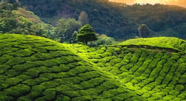
The system will use satellite and geospatial data to identify and map tea gardens accurately.
AI will help assess the health and condition of tea plants by analysing satellite images and other field data.
The system will help identify early signs of pest attacks and diseases, allowing tea growers to take timely action.
CHAAYANKAN will use data and AI models to estimate the quantity of green tea leaves that can be produced.
Weather information such as temperature, rainfall and other environmental conditions will be used to understand their impact on tea plantations.
Drones will provide detailed field-level information, while satellites will help monitor large tea-growing areas.
The project will initially focus on major tea-producing states, including:
These states are among India's important tea-growing regions.
CHAAYANKAN will use Artificial Intelligence and Machine Learning to analyse large amounts of plantation-related data. It will also use real-time field data and insect-related studies to improve the identification of pest risks and support better plantation management.
|
Organisation |
Role |
|
Tea Board of India |
Implementation and support for the tea-sector project |
|
ISRO's National Remote Sensing Centre (NRSC) |
Satellite and remote-sensing technology |
|
NIT Rourkela |
Research, AI and data-analysis support |
Geospatial technology refers to technologies used to collect, analyse and display information linked to a particular location on Earth. It includes technologies such as satellite imagery, remote sensing, Geographic Information Systems (GIS) and GPS.
Remote sensing means collecting information about an object or area without directly coming into physical contact with it. In this project, satellite images and other remote-sensing technologies will help monitor tea plantations over large areas.
The project can help make tea plantation management more scientific, efficient and data-driven.
It is expected to:
CHAAYANKAN represents the use of AI, satellite technology, drones, weather data and field information to modernise tea plantation monitoring in India. By providing timely and accurate information, the project aims to improve productivity for tea growers and support better policymaking for India's tea industry.
Prelims Practice QuestionQ1. Consider the following statements regarding CHAAYANKAN:
Which of the statements given above are correct? A. 1 and 2 only Mains Practice QuestionQ. How can the CHAAYANKAN project improve tea plantation management, productivity and evidence-based policymaking through AI, remote sensing and geospatial technology? |
Q1. What is CHAAYANKAN?CHAAYANKAN is an AI-based geospatial data analytics project for monitoring tea plantations. Q2. What is the full form of CHAAYANKAN?Comprehensive AI-based Geospatial Data Analytics for Tea Plantation Monitoring. Q3. Which organisations are involved in CHAAYANKAN?The Tea Board of India, ISRO’s National Remote Sensing Centre (NRSC), and NIT Rourkela. Q4. What technologies will CHAAYANKAN use?It will use AI, Machine Learning, satellite data, drones, weather information and field data. Q5. What are the major applications of CHAAYANKAN?It will help with tea-garden mapping, crop-health monitoring, early pest and disease detection, and green-leaf yield estimation. |

Our support team will be happy to assist you!

 Contact Us
  New Batch : 9555124124/ 7428085757
  Tech Support : 9555124124/ 7428085757