New
Final Result - UPSC CSE Result, 2025 GS Foundation (P+M) - Delhi : 23rd March 2026, 11:30 AM GS Foundation (P+M) - Prayagraj : 17th March 2026 Final Result - UPSC CSE Result, 2025 GS Foundation (P+M) - Delhi : 23rd March 2026, 11:30 AM GS Foundation (P+M) - Prayagraj : 17th March 2026

India Tests Floating LiDAR Buoy to Boost Offshore Wind Mapping and Ocean Forecasting

Prelims: (Science & Technology + CA)
Mains: (GS 3 – Science & Technology, Environment, Energy Security)

Why in News ?

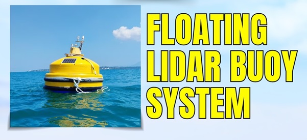
The National Institute of Ocean Technology (NIOT) has successfully tested an indigenously developed Floating LiDAR Buoy System off the coast of Muttom.

This marks a significant step in enhancing India’s capabilities in offshore wind energy assessment and ocean observation technologies.

Background and Context

India is rapidly expanding its focus on renewable energy, including offshore wind power, to meet its clean energy targets.

However, offshore wind development requires accurate, long-term wind data over the sea, which is difficult to obtain due to:

  • Harsh marine conditions
  • Limited fixed infrastructure
  • High costs of traditional measurement systems

To address these challenges, institutions like the National Institute of Ocean Technology have developed advanced ocean-based instruments such as the Floating LiDAR Buoy System.

About Floating LiDAR Buoy System

The Floating LiDAR Buoy System is a high-tech ocean instrument used to measure atmospheric and wind conditions over the sea.

Key Features

  • Combines:
    • A floating buoy platform
    • Light Detection and Ranging (LiDAR)
  • Provides real-time and high-precision data
  • Operates in remote offshore environments

Purpose

  • Measure:
    • Wind speed and direction
    • Wind variations at different heights
  • Support:
    • Offshore wind energy projects
    • Weather and climate research

Working of the System

Principle

The system is based on Light Detection and Ranging (LiDAR) technology.

Mechanism:

  • The buoy floats on the ocean surface
  • Emits laser pulses into the atmosphere
  • Pulses hit particles (dust, aerosols) and reflect back
  • Returned signals are analysed to determine:
    • Wind speed
    • Wind direction
    • Atmospheric patterns

Unique Capability

  • Measures wind data up to 300 metres above sea level
  • Provides continuous, high-resolution data
  • Works efficiently where traditional instruments fail

Significance of the Development

1. Boost to Offshore Wind Energy

  • Enables accurate wind resource assessment
  • Reduces uncertainty for offshore wind investments
  • Supports India’s clean energy targets

2. Improved Weather Forecasting

  • Enhances:
    • Wind prediction models
    • Marine weather forecasting

3. Better Cyclone Tracking

  • Provides real-time data critical for:
    • Early warning systems
    • Disaster preparedness

4. Climate Change Research

  • Helps study:
    • Ocean-atmosphere interactions
    • Changing wind patterns

5. Technological Self-Reliance

  • Indigenous development aligns with:
    • Atmanirbhar Bharat
  • Reduces dependence on imported technologies

Broader Applications

  • Offshore infrastructure planning
  • Maritime navigation safety
  • Fisheries and coastal management
  • Oceanographic research

Challenges

  • High initial cost of deployment
  • Maintenance in harsh marine environments
  • Need for integration with national data systems

Way Forward

  • Scale up deployment along India’s coastline
  • Integrate with offshore wind policy frameworks
  • Promote collaboration between:
    • Research institutions
    • Industry
  • Strengthen marine data infrastructure

FAQs

1. What is a Floating LiDAR Buoy System ?

It is an ocean-based system that uses laser technology to measure wind and atmospheric conditions over the sea.

2. Which organisation developed it in India ?

The National Institute of Ocean Technology (NIOT).

3. What is LiDAR technology ?

It is a remote sensing method using laser pulses to measure distances and atmospheric conditions.

4. Why is it important for offshore wind energy ?

It provides accurate wind data, essential for planning and installing offshore wind farms.

5. How does it help in disaster management ?

It improves weather forecasting and cyclone tracking, aiding early warning systems.

Have any Query?

Our support team will be happy to assist you!

OR
X