Prelims: PM GatiShakti National Master Plan, BISAG-N, Network Planning Group, Geospatial Technology, Unified Geospatial Interface, Integrated Transport and Logistics Authority.
Mains: GS Paper II – Governance, Interdepartmental Coordination and Cooperative Federalism; GS Paper III – Infrastructure, Transport Networks, Logistics and Economic Development.
Keywords: PM GatiShakti five years, PM GatiShakti National Master Plan, infrastructure planning, multimodal connectivity, BISAG-N, Network Planning Group, logistics efficiency, district master plan, ITLA, Viksit Bharat 2047. |
Why in News?
- The PM GatiShakti National Master Plan, launched in October 2021, completed five years in October 2026.
- According to the Ministry of Commerce and Industry, the platform integrates more than 1,800 data layers, covering 58 Central Ministries/Departments and 28 states and 8 union territories.
- The Network Planning Group (NPG) has evaluated 421 infrastructure projects worth approximately ₹20.23 lakh crore.
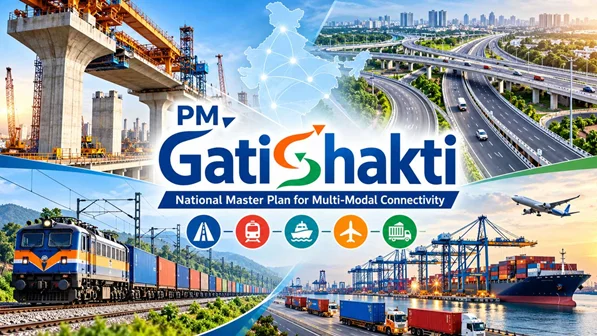
What Is PM GatiShakti?
- PM GatiShakti is a technology-based national framework for coordinated infrastructure planning. It brings geospatial information from different government departments onto a common digital platform to support better decisions.
- The platform was developed indigenously by the Bhaskaracharya National Institute for Space Applications and Geo-informatics (BISAG-N) under the Atmanirbhar Bharat initiative.
- It follows a Whole-of-Government approach, under which ministries, departments and State governments coordinate their infrastructure plans.
Major Achievements in Five Years
|
Indicator
|
Progress reported in October 2026
|
|
Geospatial data layers
|
More than 1,800
|
|
Central Ministries/Departments covered
|
58
|
|
States and Union Territories covered
|
All 36
|
|
Infrastructure projects evaluated by NPG
|
421
|
|
Total value of projects evaluated
|
Approximately ₹20.23 lakh crore
|
|
Software modules and tools
|
More than 65
|
|
Mobile and web applications
|
More than 100
|
Geospatial Technology for Integrated Planning
The platform combines location-based information to help planners understand the relationship between existing infrastructure, proposed projects and areas requiring connectivity. Its planning applications include:
- Identifying gaps in infrastructure networks.
- Assessing connections between transport systems and economic centres.
- Coordinating infrastructure requirements across departments.
- Supporting decisions on routes, locations and service coverage.
Role of the Network Planning Group
The Network Planning Group evaluates infrastructure proposals according to PM GatiShakti principles. Its evaluation framework emphasises:
- Integrated planning: Considering related infrastructure requirements together.
- Multimodal connectivity: Connecting different modes of transport.
- Intermodal connectivity: Improving transfers between transport modes.
- Last-mile connectivity: Linking transport networks with economic and social facilities.
- Logistics efficiency: Improving the movement of goods.
- Synchronised implementation: Aligning the execution of related projects.
The NPG provides an institutional mechanism for coordination among infrastructure agencies.
Expansion into District-Level and Social-Sector Planning
PM GatiShakti has expanded beyond major transport infrastructure to support local socio-economic planning. Its district-level applications include planning for:
- Roads and local connectivity.
- Schools and educational facilities.
- Hospitals and healthcare services.
- Water pipelines.
- Other essential public services.
This can help district administrations examine whether public facilities are accessible to the communities they serve.
Public Platform and Digital Tools
The PM GatiShakti Public platform, through the Unified Geospatial Interface (UGI), was launched in September 2025. It extends selected data and analytical capabilities to private entities and the general public. Other digital systems supporting the initiative include:
|
System
|
Main purpose
|
|
Knowledge Management System (KMS)
|
Knowledge sharing
|
|
Decentralized Data Uploading and Management System (DUMS)
|
Decentralised uploading and management of data
|
|
PMGS-NMP Dashboard
|
Infrastructure monitoring
|
Public access concerns selected capabilities and should not be understood as unrestricted access to every government data layer.
Evolution of PM GatiShakti
|
Period
|
Major developments
|
|
2021–22
|
Launch and establishment of the integrated national planning framework
|
|
2022–23
|
Eight key infrastructure ministries onboarded; 71 projects evaluated
|
|
2023–24
|
Social-sector integration; 1,463 data layers and coverage of all 36 States/UTs
|
|
2024–25
|
Economic-sector integration; District Master Plan launched; 121 projects evaluated
|
|
2025–26
|
Public platform/UGI, KMS, DUMS and Dashboard launched; evaluations reached 352 projects by February 2026
|
|
2026 update
|
Evaluations reached 421 projects worth approximately ₹20.23 lakh crore; ITLA approved
|
These figures represent milestones reported for different periods and should not be added together as separate project totals.
Integrated Transport and Logistics Authority
- The government has decided to establish the Integrated Transport and Logistics Authority (ITLA) to strengthen long-term transport and logistics planning.
- The authority is intended to strengthen multimodal infrastructure connectivity, improve infrastructure efficiency, reduce logistics costs and enhance India’s global logistics competitiveness.
Significance of PM GatiShakti
- Coordinated Governance: A common planning platform can help ministries identify dependencies between their projects and coordinate decisions.
- Better Use of Public Resources: Integrated planning can reduce avoidable duplication, repeated construction and mismatches between infrastructure investments.
- Improved Logistics Efficiency: Stronger connections among transport networks and production centres can reduce delays and improve the reliability of goods movement.
- Greater Investment Predictability: Better visibility of existing and proposed infrastructure can support more informed investment and location decisions.
- Improved Public-Service Planning: Combining transport and social-sector information can help governments identify gaps in access to schools, healthcare and other services.
Relevance for India
- Manufacturing competitiveness: Reliable connectivity can improve access to suppliers, markets and export gateways.
- Regional development: District-level planning can help identify infrastructure gaps in underserved areas.
- Cooperative federalism: Participation by Central Ministries and all States/UTs provides a framework for coordinated planning across levels of government.
- Supply-chain resilience: Better-connected transport networks can provide greater flexibility when individual routes face disruption.
- Viksit Bharat 2047: Integrated infrastructure planning supports the broader objective of sustained economic development.
These are potential benefits; their realisation depends on project execution and measurable improvements in service delivery.
Challenges
The following are analytical implementation challenges, rather than findings of failure reported in the anniversary release.
- Data Accuracy and Timely Updates: Planning decisions depend on reliable information. Outdated or incomplete data can reduce the usefulness of the platform.
- Uneven Administrative Capacity: District and local authorities may require additional geospatial expertise, trained personnel and digital infrastructure.
- Coordination During Execution: Sharing a platform does not automatically resolve differences in departmental budgets, priorities and implementation schedules.
- Land and Environmental Constraints: Geospatial planning can help identify constraints early, but land acquisition, environmental assessment and community consultation still require effective institutional processes.
- Data Security and Access Management: Expanding public and private participation requires clear controls over access to sensitive infrastructure information.
- Measuring Actual Outcomes: The number and value of projects evaluated do not, by themselves, establish reductions in logistics costs, delays or regional disparities.
Way Forward
- Improve data governance: Establish clear responsibilities for data validation, updating and interoperability.
- Strengthen district capacity: Train officials in geospatial analysis and integrated planning.
- Align project schedules: Coordinate construction timelines and supporting infrastructure requirements.
- Track measurable outcomes: Monitor travel time, freight reliability, service access, project delays and cost overruns.
- Integrate sustainability: Incorporate environmental sensitivity, disaster risk and climate resilience into planning.
- Operationalise ITLA effectively: Define its mandate and coordination arrangements clearly.
- Enable appropriate public access: Expand useful analytical services while protecting sensitive information.
Conclusion
PM GatiShakti’s first five years mark the expansion of a common digital planning platform into a broader system supporting infrastructure, district-level and social-sector development. Its long-term success will depend on translating coordinated planning into timely projects, efficient logistics and better access to essential services.
Prelims Practice Question
Which institution developed the geospatial digital platform for the PM GatiShakti National Master Plan?
(a) NITI Aayog
(b) Bhaskaracharya National Institute for Space Applications and Geo-informatics
(c) National Highways Authority of India
(d) National Statistical Office
Mains Practice Question
“Integrated infrastructure planning is as much a governance reform as a technological intervention.” Discuss with reference to PM GatiShakti, highlighting its achievements and implementation challenges.
|
Frequently Asked Questions
1. What is the PM GatiShakti National Master Plan?
PM GatiShakti is a national framework that uses a shared geospatial digital platform to coordinate infrastructure planning across ministries, departments, States and Union Territories.
2. When was PM GatiShakti launched?
It was launched in October 2021 and completed five years in October 2026.
3. What are its major achievements as of October 2026?
The platform integrates more than 1,800 data layers across 58 Central Ministries/Departments and all 36 States/UTs. The NPG has evaluated 421 projects worth approximately ₹20.23 lakh crore.
4. What does the Network Planning Group do?
The NPG evaluates infrastructure proposals for integrated planning, multimodal and last-mile connectivity, logistics efficiency and synchronised implementation.
5. What is the purpose of the Integrated Transport and Logistics Authority?
ITLA is intended to strengthen transport and logistics research, planning, appraisal, monitoring and impact assessment, supporting better connectivity and infrastructure efficiency.
|




 Contact Us
  New Batch : 9555124124/ 7428085757
  Tech Support : 9555124124/ 7428085757